| The swaag.org website uses cookies to provide website use and other information. Full details | Swaledale and
Arkengarthdale Archaeology Group Swaledale Geology Pages © John Russell |
SWAAG Honorary President:
Tim Laurie FSA |
| The Stockdale Fault Location: Low Bridge, Stonesdale. Grid Ref: OL30 878 016 Camera Direction: North East Click images to enlarge |
||||||
|
||||||
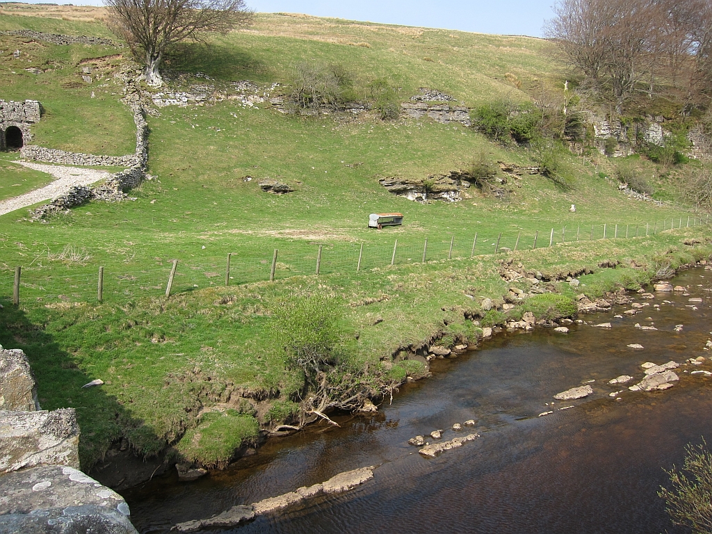
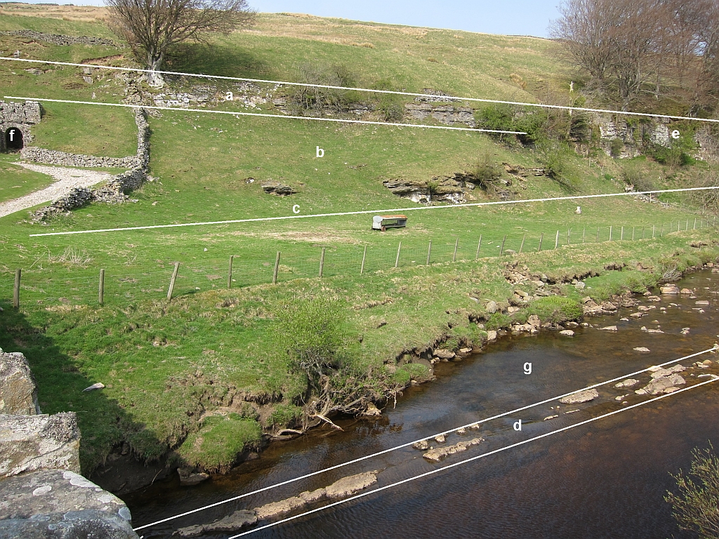
 The picture
was taken standing on Low Bridge just above Wain Wath Force. The
scar of limestone at (a) is made of the Main Limestone. If you
follow the River Swale downstream you will arrive at Wain Wath
Force which plunges over the Underset Limestone. River erosion
reveals one of the Lower Carboniferous cyclothems. A cyclothem
is a repeated series of the same rocks, caused by the land
subsiding. The picture
was taken standing on Low Bridge just above Wain Wath Force. The
scar of limestone at (a) is made of the Main Limestone. If you
follow the River Swale downstream you will arrive at Wain Wath
Force which plunges over the Underset Limestone. River erosion
reveals one of the Lower Carboniferous cyclothems. A cyclothem
is a repeated series of the same rocks, caused by the land
subsiding.There are some very disturbed and broken rocks at (d) which dip at almost 60 degrees. Compare these rocks with those at (a) which are almost horizontal. Line (c) shows the location of the Stockdale Fault. Faults are a natural weakness in the crust, and nature, when eroding the crust, preferentially attacks these broken rocks. Ice and rivers have chosen to use this routeway down the valley as the faulted rocks are least resistant to erosion. There was another mountain building episode at the end of the Carboniferous Period, known as Variscan Orogeny. This resulted in many of the faults surrounding the Askrigg Block moving. Some of these faults are still moving after 300 million years. There are two main groups of faults caused by the Earth’s crust either being squashed (compression) or being pulled apart (tension). The Stockdale Fault shows compression. A visit to this site will reveal a fault with a huge throw. The throw is the amount the fault has moved. If you stand on the bridge and look east the rocks belonging to the Millstone Grit series are on your right; to the left they are part of the Lower Carboniferous Limestone series. The downthrown side of the fault is on your right. It is likely that during the Variscan Orogeny that a lot of the mineral wealth of the dales was injected by hydrothermal fluids, along faults like the Stockdale Fault. The limestone scar marked (a) was mined just above the kiln marked (f). The limestone was burnt to produce lime to put onto fields to neutralise the acid soils. This was known as ‘sweetening’ the land. The kiln is currently being restored by the National Park. |
||||||